Friday, June 10, 2011

Riding the T

Downtown Light Rail Map
Pittsburgh Port Authority

This past week, I rode the “T” for the first time. I started in Station Square and headed north into the city, exiting at the Wood Street stop, the last station currently open. It was a convenient way to get into downtown from across the river, however, because of the limited number of open stops, it didn’t get me very far. I have travelled on many public rail systems in my life: Rome, London, Paris, NYC, DC, Zurich, Boston and Dallas to name a few, so it was hard not to compare Pittsburgh to those other systems.

T Map
Pittsburghtransit.info

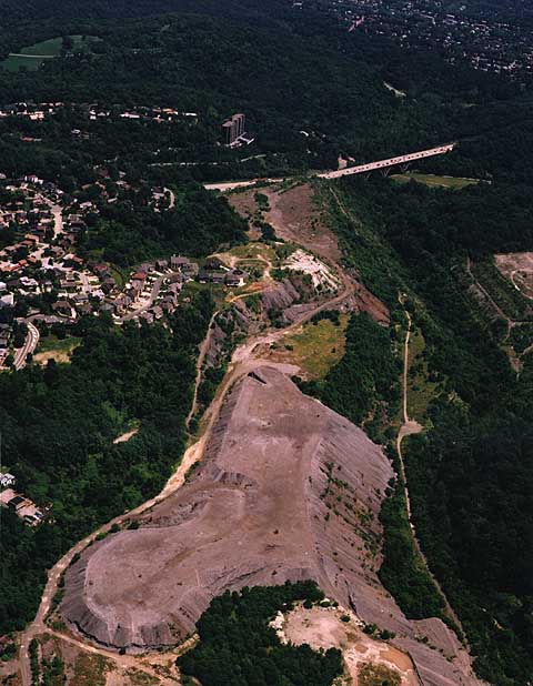
Examining the map of the current system, it is clear that the T is mostly a commuter rail. After the Station Square stop, there are only 5 downtown stops and 2 more stops under construction on the North Shore. Conversely, there are 56 stops outside of the city reaching as far as the Library and South Hills Village!
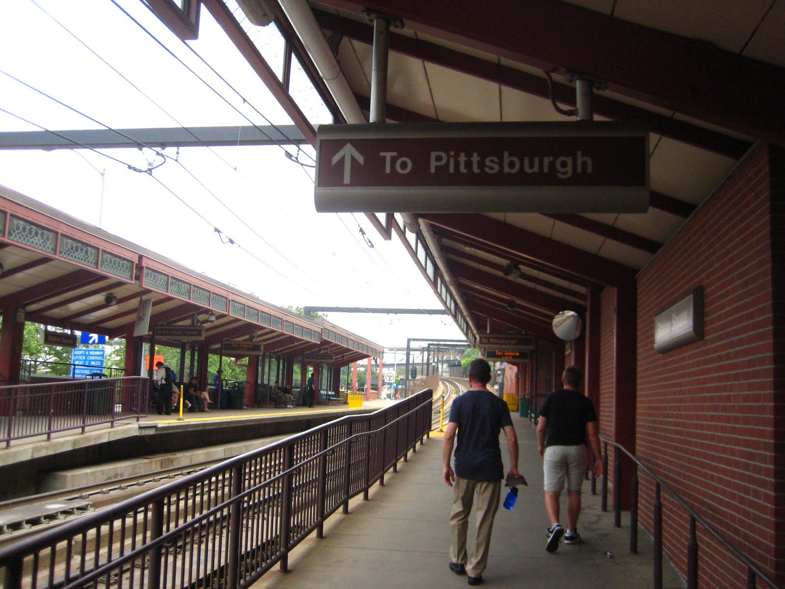
Station Sq stop
Ben Samson, 2011

It was mid afternoon, off-peak hours, when I rode the T last week, and it was still relatively busy. Here is a look at some of the details of my trip.

 You have to walk across the tracks at the stop to go north. The yellow line is where the trains stops in order not to hit pedestrians. Remember to look both ways!
Ben Samson, 2011

 The tracks- which you can stand on
Ben Samson, 2011

Platform
Ben Samson, 2011
The rail cars have 2 cars
Ben Samson, 2011

LED display
Ben Samson, 2011


Nice waiting area
Ben Samson, 2011


The electric system
Ben Samson, 2011


From the Station Square stop, we took the T north into the city, passing First Street station, Steel Plaza and we exited through Wood Street station. Here are some images of the train we entered. It felt a little old- clearly felt like the 80's when the system was built, but it was very clean.

 Train interior
Ben Samson, 2011

The Rail Map inside the trains. Note that it doesn't match the maps in the stations or maps online.
Ben Samson, 2011

Blue linoleum floor. 
Ben Samson, 2011

Matching seat fabric
Ben Samson, 2011

Train interior
Ben Samson, 2011

Here is a look at the Wood St station. It really felt a lot more substantial. The polished granite was a nice touch throughout the station. Also, the Steel Plaza station was very large and felt very metropolitan. 

Wood Street platform
Ben Samson, 2011

 Wood Street escalators- fairly packed
Ben Samson, 2011
 Wood Street escalators
Ben Samson, 2011


 Wood Street station. Not as professional as some other systems.
Ben Samson, 2011


Overall, I enjoyed exploring the T. It seems to be serving its purpose well, though is a little bit unrefined. It is clearly not a big presence in the city and if it took me almost 24 years of living in Pittsburgh to actually ride it, then it must not have a wide ranging purpose. The trip itself was quick, and though we only went a couple of stops, i certainly got a slice of the commuter life.

The trains were comfortable--also small-- and very clean. The materials were old, but not worn. There was a sense that it hadn't been updated in a while, but in no grave need of it. 

Some of the logistics were not very user friendly. The signage was a mess. None of the maps matched, and there was no real sense of identity to the system. We bought tickets from a teller at the Station Sq stop and we needed exact change. The stations in Downtown were clearly more substantial than at Station Sq, which added to some of the discord. 

However, none of these setbacks seemed to greatly affect the service which I found to be comfortable and efficient. Perhaps it is different during rush hour, but it the T seemed to live up to the Pittsburgh reputation of friendliness. It might have been the most amicable, and least pushy light rail I've ever used!

Sources:
http://www.pittsburghtransit.info/lrt.html

http://www.portauthority.org/PAAC/CustomerInfo/BuswaysandT/LightRailTransitSystem/tabid/186/Default.aspx


Tuesday, June 7, 2011

The Image of the Steel City

In Kevin Lynch's "The Image of the City," he lays out a plan for understanding the built environment of a city based on human perception of the physical form of cities. Basically, he examines how the urban fabric is imprinted in our minds and accessed in our memories.

In this post, I am going to look at a more specific way a city imprints its "image" into our minds. Pittsburgh's historic image has imprinted itself not only in our memories, but also on the physical fabric of the current post-industrial city. It is this historic image of the smokey steel mills that has defined Pittsburgh, and even now in the 21st century, with the soot gone, the city's industrial image remains prevalent.

Smokey City
Eugene Smith, 1955
In 1955, photographer Eugene Smith captured Pittsburgh's industrial spirit in his work "Dream Street, W. Eugene Smith's Pittsburgh Project." In this three-year-long project, he portrays the city as an industrial dynamo, burgeoning in its prime. The city was the backbone of the nation's steel industry and Pittsburgh steel was used to build every great American urban center.  Here is a look at some of Smith's famous pictures of the Steel City.

Dance of the Flaming Coke
Eugene Smith, 1955


Pittsburgh, Steel Worker
Eugene Smith, 1955

US Steel, Pittsburgh
Eugene Smith, 1955


Pittsburgh Steel Mill
Eugene Smith, 1955

Today, the memories that Smith captured endure. This past week, I went around town searching for some of the remnants of Pittsburgh's industrial past, and was shocked at the extent of my findings. Aside from the textures that are imprinted with the soot from the steel mills (see Pittsburgh Textures post), here are a few examples of the historic image of the city.

Smokestacks at the Waterfront
Jeff Swensen for the NY Times

Mural, An Homage to Eugene Smith
Washington Post.com


Bessemer Court, Station Sq.
Ben Samson, 2011

Nine Mile Run Slag Heap
Nature in the Post-Industrial Landscape

Blowing Machine, South Side
Ben Samson, 2011
 The Steelers
Kingdom-Biz.net

Heinz Plant, North Side
Marantzer, Flickr, 2008

US Steel Tower, Tallest Structure between NYC and Chicago
GlassSteelAndStone.com


Though the steel industry is gone, its presence remains ubiquitous. It is something that the city cherishes, and owes its character. Pittsburgh remains a blue collar town (at least in feel). The people embrace their working-class roots. This history is a source of pride.  It is evident in the name of the NFL team, the Steelers, who are the cultural lifeblood of the city. It is seen in Pittsburgh's skyline, in the US Steel tower. Old machinery and smokestacks act now as sculptures and cultural landmarks. Hiking and Biking paths mingle along old slag heaps. 

One can find instances of the historic image of Pittsburgh in all of the five elements that compose the mental maps of cities, according to Lynch. It is found in Pittsburgh's paths, edges, districts, nodes and landmarks. 

In designing any form of public transformation, a project that could vastly reshape the "image of the city," it is critical to consider Pittsburgh's industrial history and its historic image. The system must be respectful of this heritage and should coalesce with its deep cultural impact.

Sources:

Lynch, Kevin. The Image of the City, MIT Press Cambridge, Mass. 1960.

Stephenson, Sam. Dream Street, W Eugene Smith's Pittsburgh Project. W W Norton and Co. 2001.


Pittsburgh Textures

Here is a look at a sampling of textures that I found throughout the city. It seems like most structures are brick or steel, with a few modern twists here and there. The palette is mostly dark, with deep greens and reds, but the bridges also utilize a more pastel color range. Most of the masonry around town is stained with a deep black from the decades of soot- the city's history has imprinted itself onto the urban fabric, giving the buildings a rich character and connecting each structure to its neighbor. It is as if the buildings have lived through some history together, which in turn makes the fabric seem that much more consistent.


Of course greenery is also a huge part of Pittsburgh's character too. With all the parks and mountains covered with trees, it seems like the city consists of greenery nearly as much as man-made urban fabric.

Thursday, May 26, 2011

Possible Sites for Hub Terminal

When choosing the main terminal site, I am considering many factors including:

            -Location in downtown
                        -Access to major destinations
                        -Active Presence in downtown
            -Current use of site
            -Connectivity to current transport
                        -Train lines
                        - T lines and stations
                        -Busways and rights-of-way
                        -Pedestrians
                        -Parking options
            -Site Context
                        -Topography
-Sunlight and wind patterns
                        -Proximity to rivers
                        -Surrounding building types and roadways
                        -Density

 Possible sites
Source: Manipulated Google Map

After a preliminary look at downtown, I have selected six possible sites:
1.     Current Amtrak Station Site
2.     Bigelow and 7th Site
3.     Steel Plaza Site
4.     Blvd of Allies Site
5.     Northeast of Market Square Site
6.     8th and Fort Duquesne Site


1. Current Amtrak Station Site (Manipulated Google Earth)

Pros:
-Function already in place as rail station
-Excellent connectivity to current transport
            -Train
            -Busway
            -Parking
-Site and surroundings currently under-utilized

Cons:
-Challenging topography to south
-Surrounding roadways are dominant
-Not a great central location to downtown

2. Bigelow and 7th Site (Manipulated Google Earth)

Pros:
-Good connectivity to current transport
            -Train
            -Busway
-Site currently is a green patch- No one uses it!

Cons:
-Challenging topography to south
-Surrounding roadways cut through site
-Odd shape, but large
-Location in downtown is better than option 1, but not much

3.  Steel Plaza Site (Manipulated Google Earth)

Pros:
-Is the site of current T station
-Good connectivity to current transport
            -Close to train lines
            -Within vicinity of busway
-Good presence in city, on Grant St

Cons:
-Between the two biggest skyscrapers in town
-Area might be to dense, current park is good  land-use
-Too small to include rail

4. Blvd. of Allies Entrance Site (Manipulated Google Earth)

Pros:
-Good connectivity to current transport
            -Is very close to site of current T station
            -On train lines        
-Fair presence in city, on Blvd of Allies
-Site is under-utilized
-Right density for large station

Cons:
-Fair proximity to major destinations
-Current Building on SW of site 
-Might span the Blvd

5. Northeast of Market Square (Manipulated Google Earth)

Pros:
-In the center of Downtown
-Site is under-developed (buildings are in poor shape)
-Excellent pedestrian use
-Could open onto Market Square

Cons:
-No train connection 
-No current T lines in area
-Site is most developed of the ones examined

6. 8th and Fort Duquesne Site (Manipulated Google Earth)

Pros:
-Site is under-developed (buildings are in poor shape)
-Fair pedestrian use
-Proximity to convention center and stadiums
-Proximity to river, nice views
-Large site

Cons:
-Train connection through spur 
-No current T lines in area
-North of central downtown


Wednesday, May 25, 2011

Reaction to ECTS and ECTS-TA

The Eastern Corridor Transit Studies, or ECTS (2003) and ECTS-TA (2006), are studies whose goals were to investigate public transportation needs for the Pittsburgh metro area and to recommend implementing several transit investments. The studies evaluate cost effectiveness, ridership, convenience, and TOD opportunities.

The area examined is “bounded by the Golden Triangle in downtown Pittsburgh to the west, the western suburbs of Westmoreland County on the east, the Allegheny River to the north, and the Monongahela River to the south.”

Study Area
Source: ECTS-TA

The principles in the study include:

            -Consideration of public opinion through targeted outreach
            -Coordination with other study efforts including:
                        -Oakland Transportation Study
                        -Six Point Plan (2006)
                        -Mass Transit Alternatives (2005)
                        -Transit Oriented Communities and the Regional Transit Vision
                        -North Shore Connector
            -Evaluation of cost effectiveness, ridership, driving alternatives and TOD
            -Identification of Potential Funding
           
Final recommendations of the study:

Most of the six main alternatives were well received by outreach programs. These alternatives include extending the East Busway Extension, the construction of Allegheny Valley Commuter Rail, and construction of Mon Valley and “Spine Line” Light Rail systems.
Final Recommendations
Source: ECTS-TA
My thoughts:

The ECTS is a complete and comprehensive study for the region. The study is highly believable and encouraging, making it seem desirable and feasible to build many different forms of public transportation in the area.The study even outlines potential funding.  

While it does examine many modes of transportation, and it rates public responses, the study is not discriminating with its final recommendations. If all of the final recommendations were to be built, the region would be much better connected, however, the current lack of regional continuity between modes of public transport would persist. 

I would push for one major mode of public transportation with a clear identity and purpose for riders. This approach would stress the use of one form of ticketing and easy access and interconnectivity of the stations. My initial reaction would be to implement a light rail system throughout the region that would connect to current "T" and ongoing North-shore connector. The study clearly proves its feasibility.

Sources:

ECTS http://www.alleghenyplaces.com/docs/SupportingDocuments/Transportation/ECTS%20Study%20Summary.pdf 

ECTS-TA
http://www.spcregion.org/ECTS/pdf/ta-final/ECTS-TA%20Final%20Report.pdf

Final Map
http://www.spcregion.org/ECTS/pdf/RecAlt.pdf